


Different activities aiming to improve river dynamics, water regime and overall ecological conditions of the area are undergoing in the Danube river branch system under the project LIFE14 NAT/SK/001306 Restoration and management of Danube floodplain habitats. A restoration progresses in collaboration with the Water Research Institute and project partners – deposits are being removed from the branches and wetlands, existing weirs (barriers) are being rebuilt in order to revive the flowing parts and direct the water to places it once used to flood. One of the solutions for the branch system is the re-introduction of so-called simulated floods in the area that was strongly affected by human activities. Thanks to the project, simulated floods have been taking place every year since 2016. Long-term underground water levels and surface water levels monitoring is carried out in the area, data collection and equipment maintenance require a lot of fieldwork. During preparations and execution of simulations, we saw a need for timely access to current data on water levels and information on the safety and accessibility of fords that are frequently used by various subjects (water management workers, foresters, nature conservationists, hunters, fishermen, land owners), as well as by the general public.

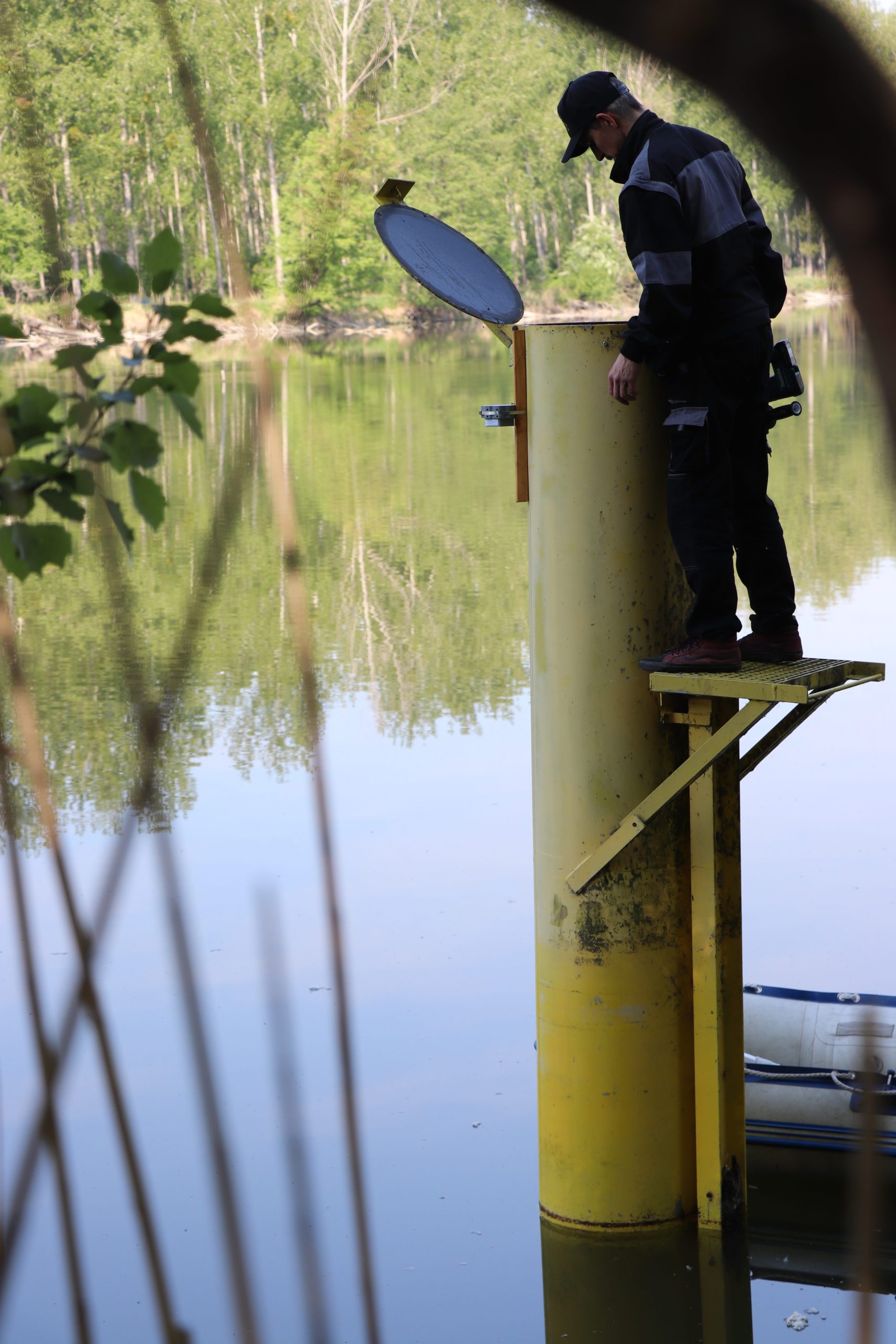
The WRI in collaboration with GOSPACE Tech s.r.o. installed 12 pieces of MERATCH measuring devices in the weirs within the Danube river branch system in order to monitor the water levels with an accuracy of 1 mm. Data are sent to the main server through the latest wireless NB-IoT network every hour for further processing. The devices are powered by batteries and their expected operation time is more than 5 years.

GOSPACE aims to help automating and digitizing the hydrological measurements. The goal is to make the data accessible online, at all times and even from spots with limited access. This is one of the reasons, why GOSPACE uses MERATCH – Measure & Watch Online devices in collaboration with national authorities for surface and underground water monitoring projects in remote locations. This innovative technology saves time, money, and the environment. GOSPACE is ready to implement the technology all over the world.

Meratch website provides the visitors with information on water levels on weirs and safety of fords that may get flooded during the regular spring and summer simulated floods or natural floods. Experts and general public can check out the charts on water level changes which raises awareness and data accessibility to all parties involved.

Besides having access to the public data, the WRI can send out alerts in case water level limits are exceeded. An app based on mathematical models of a given area helps the water managers to determine and set the required water levels on weirs during simulated floods. Therefore, a collaboration of water managers and innovative technology developers helps to improve the management of the unique natural environment of the so-called Danube inland delta, where nature conservation goals meet other ecosystem services provided by the area.
Detailed monitoring with the use of automated data transfer is more efficient and considerate towards nature than previously used processes and can be implemented even in inaccessible locations without a mobile reception thanks to new generation IoT networks.
